Cyclone Montha Live Tracking: IMD Weather Alert as Storm Intensifies Over Bay of Bengal in the last 24 hours
6 min read
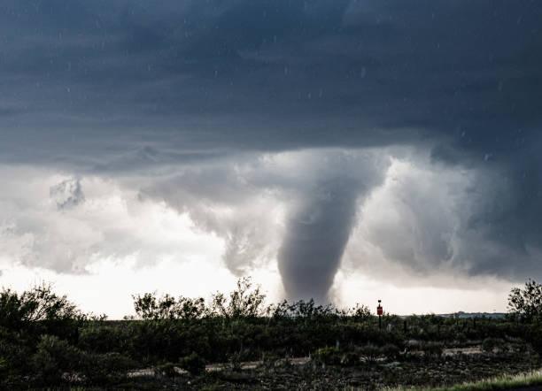
A huge dark cloud with a swirling funnel in southwest Texas
Red alert issued for Odisha and Andhra Pradesh as Cyclone Montha approaches with heavy rain forecast; landfall expected October 28
Cyclone Montha is rapidly intensifying over the Bay of Bengal, prompting the India Meteorological Department (IMD) to issue red and orange weather alerts across multiple states. The cyclonic storm, expected to make landfall near Kakinada in Andhra Pradesh on October 28, has triggered massive evacuation efforts and emergency preparations across eastern India’s coastal regions.
As of today, the IMD weather forecast confirms that Cyclone Montha is moving west-northwest at approximately 18 kilometers per hour, positioned about 850 kilometers southeast of Gopalpur in Odisha and 680 kilometers from the Andhra Pradesh coast. The system is expected to strengthen into a severe cyclonic storm with wind speeds reaching 90-100 km/h and gusts up to 110 km/h.
Today Weather Update: Red Alert for 8 Odisha Districts
The Odisha government has placed eight southern districts under red alert as Cyclone Montha live tracking shows the storm steadily approaching the eastern coastline. Districts including Ganjam, Gajapati, Rayagada, Koraput, Malkangiri, Nawarangpur, Kalahandi, and Kandhamal are bracing for extremely heavy rainfall between October 27-29.
Today’s rain patterns have already begun affecting coastal areas, with Koraput district experiencing continuous rainfall since early morning. The IMD weather bulletin warns that today’s weather conditions will deteriorate significantly as the cyclone intensifies, bringing widespread precipitation across vulnerable regions.
Disaster management teams have been deployed across all 30 districts of Odisha, with 128 specialized response units positioned strategically. The state’s Revenue and Disaster Management Minister confirmed that 15 districts will likely experience the cyclone’s impact, with preparations including premature paddy harvesting by concerned farmers attempting to minimize crop losses.
Cyclone Montha Live Tracking: Current Position and Movement
According to the latest Cyclone Montha live updates, the deep depression formed over the southeast Bay of Bengal early on October 26 and has been continuously monitored by the IMD. The cyclone live tracking system shows the storm’s current coordinates place it directly on course toward the Andhra Pradesh coastline, with landfall predicted between Machilipatnam and Kalingapatnam.
The IMD weather monitoring stations report that Cyclone Montha developed from a well-marked low-pressure area that formed on October 25. Within 48 hours, favorable environmental conditions including warm sea surface temperatures exceeding 28-29°C and low to moderate wind shear enabled rapid intensification into a deep depression and subsequently into a named cyclonic storm.
Meteorological experts conducting Cyclone Montha live tracking emphasize that the system’s west-northwest trajectory remains consistent, though slight variations could alter the precise landfall location. Coastal communities between Visakhapatnam and Machilipatnam should remain on highest alert as today’s weather patterns indicate the outer bands of the cyclone are already producing rain and gusty winds.
Heavy Rain Forecast: Which Areas Will Be Affected
Today’s rain is just the beginning of what meteorologists predict will be widespread heavy to extremely heavy precipitation across multiple states. The IMD weather forecast specifies that rain will intensify dramatically on October 28-29 as the cyclone makes landfall.
Andhra Pradesh faces the most severe threat, with red alerts issued for seven districts: SPSR Nellore, Prakasam, Bapatla, Krishna, West Godavari, Dr. B.R. Ambedkar Konaseema, and Kakinada. These regions should expect extremely heavy rainfall potentially exceeding 20 centimeters in 24 hours, accompanied by damaging winds and storm surge.
In Odisha, today’s weather advisory warns residents to prepare for heavy rain that will persist through midweek. The cyclone in Odisha will not make direct landfall but will produce significant rainfall and gusty winds reaching 40 km/h across southern and coastal districts. Fishermen have been strictly prohibited from venturing into the sea until October 29 as conditions deteriorate.
Tamil Nadu’s northern districts, particularly Kanyakumari, Tenkasi, Thoothukkudi, and Tirunelveli, are experiencing moderate to heavy rain today with thunderstorms and lightning. Chennai weather today remains cloudy with intermittent showers and temperatures hovering between 25-31°C.
IMD Weather Bulletin: What to Expect Next 48 Hours
The IMD weather department has issued comprehensive advisories detailing expected conditions as Cyclone Montha approaches. According to the latest bulletin, the cyclone will transition from a cyclonic storm to a severe cyclonic storm by early October 28, coinciding with landfall.
Today’s weather monitoring indicates wind speeds will progressively increase from current levels of 55-65 km/h with gusts to 75 km/h, eventually reaching maximum sustained winds of 90-100 km/h and gusts to 110 km/h at landfall. Coastal areas will experience storm surge of 1-2 meters above astronomical tide, potentially inundating low-lying regions.
The IMD has raised Distant Cautionary Signal 1 (DC-1) at all Odisha ports and warned of rough to very rough sea conditions. Today rain patterns across the Bay of Bengal region show increasing intensity, with satellite imagery revealing well-organized convection around the cyclone’s center.
Cyclone in Odisha: Preparedness and Evacuation Measures
While the cyclone in Odisha will not make direct landfall, authorities are taking no chances given the state’s vulnerability to cyclonic weather systems. The Odisha government has initiated evacuation procedures in low-lying coastal areas, with shelters prepared to accommodate displaced residents.
Schools and colleges across affected districts have been closed as a precautionary measure. The Puri district administration has banned bathing at sea beaches from October 27-29, recognizing the dangerous conditions created by high tidal waves and strong undercurrents associated with the cyclone in Odisha’s coastal waters.
Emergency response protocols include positioning of National Disaster Response Force (NDRF) teams, stockpiling essential supplies, ensuring fuel availability, and establishing 24/7 control rooms for coordinated disaster management. The state’s experience with previous cyclones like Super Cyclone of 1999 and Cyclone Fani in 2019 has informed current preparation strategies.
Chennai Weather Today and Tamil Nadu Impact
Chennai weather today reflects the cyclone’s influence, with residents experiencing cloudy skies, periodic rainfall, and rising wind speeds. While Tamil Nadu faces less severe impact compared to Andhra Pradesh and Odisha, the state’s northern districts remain under orange alert.
The IMD has placed yellow alerts for Thiruvallur, Chengalpattu, Chennai, and Kanchipuram, indicating light to moderate rain with possible thunderstorms. The Indian Coast Guard has urged fishermen to return to shore and avoid venturing into the sea as conditions in the Bay of Bengal remain hazardous.
Tamil Nadu’s disaster management authorities have advised residents to stay indoors during heavy rain periods, avoid unnecessary travel, and remain updated through official channels regarding today’s weather developments and Cyclone Montha’s progression.
Real-Time Updates: How to Track Cyclone Montha
For those seeking Cyclone Montha live tracking information, the IMD provides regular bulletins through its official website (mausam.imd.gov.in) and social media channels. The IMD weather updates include current position, intensity, movement direction, and revised forecasts every three hours.
Today’s weather can be monitored through various platforms including state meteorological centers, local news channels, and official government disaster management websites. Residents in affected areas should prioritize information from authenticated sources rather than unverified social media posts during this critical period.
Mobile applications and SMS alert systems have been activated across vulnerable regions to ensure timely dissemination of cyclone live updates. Emergency helpline numbers have been publicized for citizens requiring assistance or information about evacuation procedures, shelter locations, and safety protocols.
Safety Measures and Precautions During Heavy Rain
As today’s rain intensifies ahead of Cyclone Montha’s arrival, residents must adopt comprehensive safety measures. During heavy rain and cyclonic conditions, people should remain indoors, secure loose objects that could become projectiles in high winds, and stock adequate supplies of food, water, medicines, and emergency equipment.
The IMD weather advisory emphasizes avoiding flooded areas, staying away from electrical installations, and keeping mobile devices charged for emergency communication. Coastal communities should evacuate when instructed by authorities, recognizing that delayed evacuation could prove life-threatening as conditions deteriorate.
Agricultural communities experiencing today’s rain should take immediate steps to protect standing crops where possible, secure livestock in safe shelters, and avoid venturing into fields during storm conditions. Post-landfall recovery efforts will require coordinated community action supported by government disaster relief programs.


